
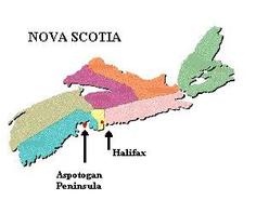
Trails Along The South Shore - The Aspotogan Peninsula
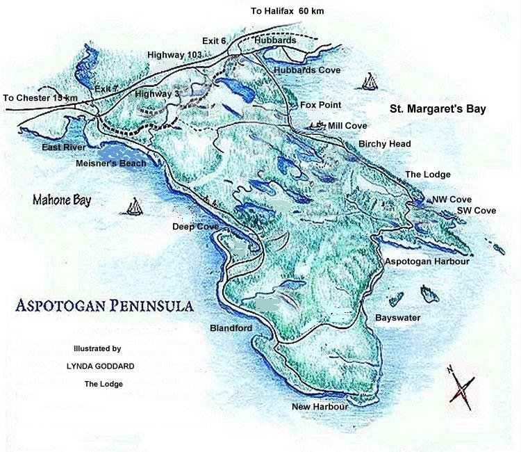
Source: http://www.aspotoganpeninsula.com/map.htm
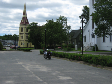
Photo of two of the three waterfront churches, Mahone Bay, NS (G. Matthews photo)
Bridgewater, NS to Aspotogan Peninsula.
Leave the town of Bridgewater (“The Main Street of the South Shore”) and head east via Route 3. The road for the most part is in really good shape, having had much of it repaved in the last several years (as always, there are exceptions where some of the road is a bit "well used" but the scenery more than makes up for it.
Between Bridgewater and Mahone Bay, the road is smooth and makes for a good chance to group ride if more than one rider (speed limit up to 80 km/h through most of it). Entering the town of Mahone Bay, the speed is reduced to 50 km/h, but you will find that as you get to the downtown core, speed is forced to slow down because of the "slow pace" offered by the touristy town. You have ridden approximately 15 minutes so far.
Staying on Route 3 will have you ride by the famous three churches of Mahone Bay on one side (one of the most photographed scenes in Nova Scotia), and the Mahone Bay itself on the other. Exiting Mahone Bay, continue on to Martins River, and the road is smooth and a bit twisty, where the speed limits change and sneak up on you, but you will want to only have a leisurely pace along here anyway. At the Martins River bridge, the new pavement stops and the well used section begins (nice view of the former Halifax and Southwest railroad train trestle on the left, which is now part of the recreational trail from Halifax to Yarmouth).
Continue on to Gold River / Western Shore, where you will pass by the Oak Island, famous for the story, real or not, of Captain Kidd’s buried treasure, which many have tried to find, but no one has been successful in doing. At Western Shore, the view of the of the bay is spectacular ( it is real cold in the spring when the wind blows off the water - brrr ).
The journey continues until you come to Chester Basin (more beautiful scenery) and then into Chester village. Turn right ( basically go straight ahead) just after you pass the tourist bureau, which was the train station in Chester) at the sharp turn (if you follow the main road, you are still on Route 3) but you want to take a detour into Chester itself to look at the sights, sounds, and smells of this famous village. You will end up along the waterfront and will note that streets are narrow and the speed slow. That is OK, because you will not want to go any faster, anyway!
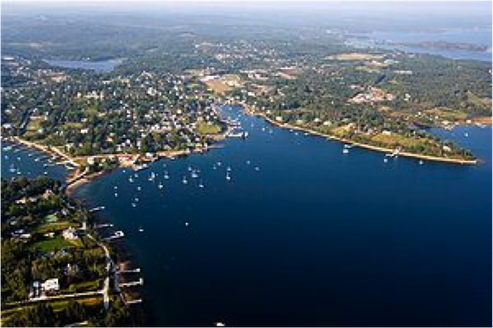
Aerial view of Chester, NS http://en.wikipedia.org/wiki/Chester,_Nova_Scotia
Back out on Route 3, and if you did not stop at one of the little shops in the village for refreshments, there is always Tim Horton's (they are everywhere !) if you have been taking your time, it has been approximately 20 minutes or so from Mahone Bay to Chester.
From Chester continue to head toward Halifax, past Graves Island Provincial Park, into East Chester (the road along here is a bit on the bumpy side in places, best to stay close to the centre line riding position and ride single file if group riding), then turn off on Route 329 to the right and head toward Blandford. (still part of the Lighthouse Route)
The road is in good shape and the riding is pleasurable. Although you are riding on a peninsula, the first part of the ride does not offer views of the Mahone Bay, for approximately 10 minutes. You know the water is there, and can see short snippets of it, it is not until you spend a few minutes riding through forested area. Once you get to the waterfront, you can stop and get a good view of the islands and the peninsula itself. Awesome is only the beginning.
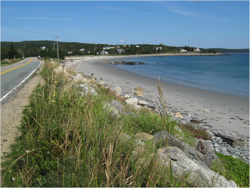
Looking at part of the Aspotogan Peninsula at Blandford, NS Photo: G. Matthews
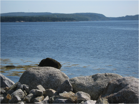
Continue on to Blandford
( more great scenery) careful of the sharp left turn that continues as the 329, but if you go straight, the road is paved and the scenery will not let you down, but you will have to retrace your steps as it is a dead end road.
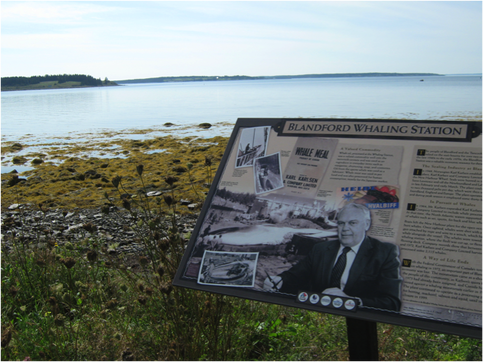
Beautiful and Historic Blandford - A Major Whaling Centre of By-Gone Days
We now enter the community of Bayswater, which has a fabulous beach and provincial picnic park. It is also home to one of two memorials dedicated to the tragedy of SwissAir Flight 111 that crashed into the ocean, not far from here. All lives were lost in the tragedy, with many of the local fishermen aiding in the hope-to-be rescue of any survivors, and still haunts many of the locals today.
It is indeed worthwhile to stop and reflect on both the tragedy and the courage of the local population.
It is indeed worthwhile to stop and reflect on both the tragedy and the courage of the local population.
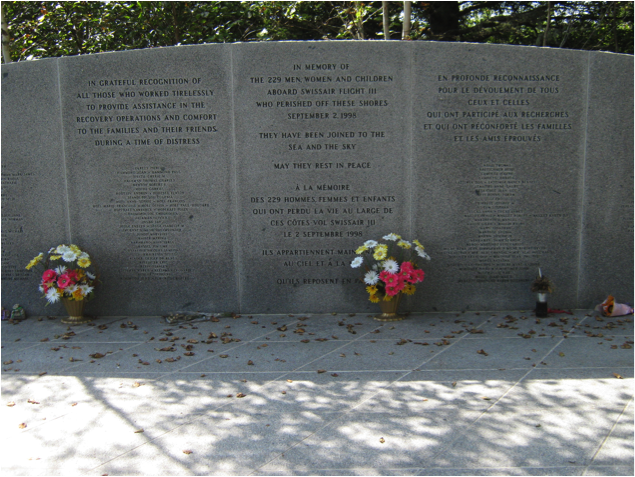
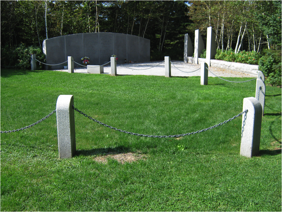
Swiss Air Flight 111 Memorial at Bayswater
Bayswater Beach..... Photos: G.Matthews
On a happier note, you can enjoy the beach (extremely busy in the summer, but not so much out of season which is great if you want beach room).
Now starts the fun stuff as the road was recently repaved, and the twists get tighter, and for the next 7 km or so. The important item here is to remember to slow down and take in the scenery, which is spectacular, but don't look at it as you may be tempted to "follow your eyes". However, if your intention is to have a bit of fun and enjoying the road, this is the place for you. The road finally takes you to the community of Hubbards ( for those of us old enough to remember, the CBC drama "Black Harbour" was filmed here for a number of years.
Now starts the fun stuff as the road was recently repaved, and the twists get tighter, and for the next 7 km or so. The important item here is to remember to slow down and take in the scenery, which is spectacular, but don't look at it as you may be tempted to "follow your eyes". However, if your intention is to have a bit of fun and enjoying the road, this is the place for you. The road finally takes you to the community of Hubbards ( for those of us old enough to remember, the CBC drama "Black Harbour" was filmed here for a number of years.
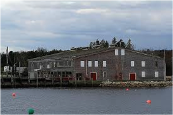
The Old Fish Plant in Hubbards (scene of "Black Harbour")
In this ride, I took a left turn at the intersection of Route 329 and Highway 3, and headed back in the direction of Bridgewater, from where I came. The road here is a bit rougher but still good to travel on, mostly in single lane if riding as a group. Within 10 minutes of entering Highway 3 again, we have come full circle of the Aspotogan Peninsula, in our return to Bridgewater. The Aspotogan Peninsula ride is indeed one of the many gems found along the South Shore of Nova Scotia!
