
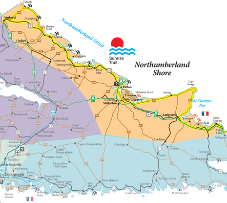
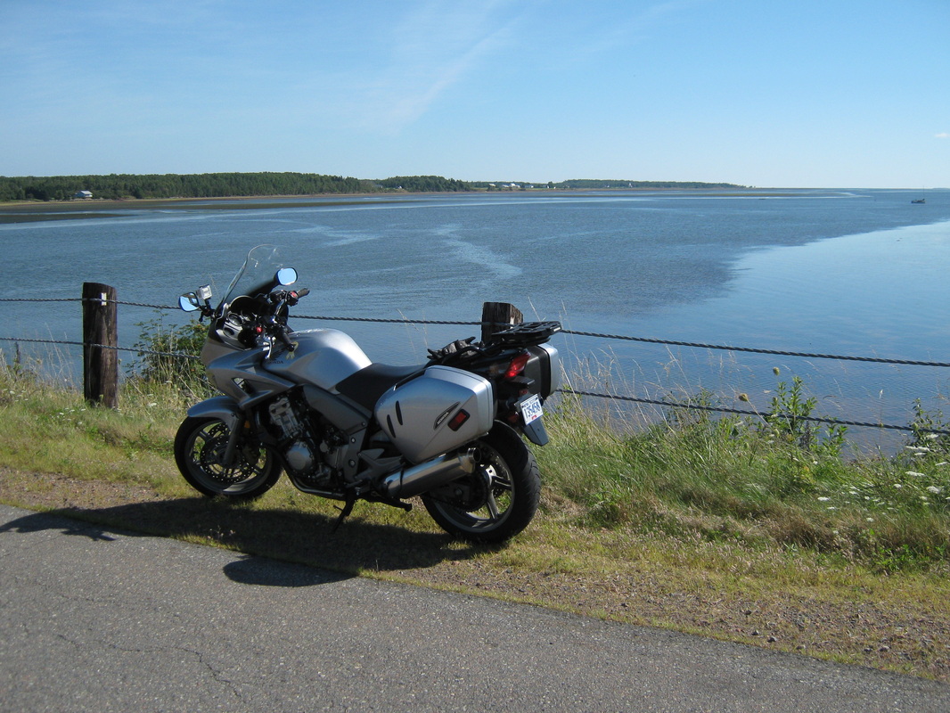
While in the New Glasgow area visiting family, I thought it might be interesting to go for a short ride through part of the “Sun Rise Trail”, of North-Central Nova Scotia. The trail runs along the Northumberland Strait that separates Nova Scotia from the province of Prince Edward Island. The waters here in the summer are among the warmest north of the Carolinas in the USA.
Leaving New Glasgow, head toward Route 6, via rotary in Pictou, along the North Shore, or otherwise known as Northumberland Shore, and head west.
Leaving New Glasgow, head toward Route 6, via rotary in Pictou, along the North Shore, or otherwise known as Northumberland Shore, and head west.
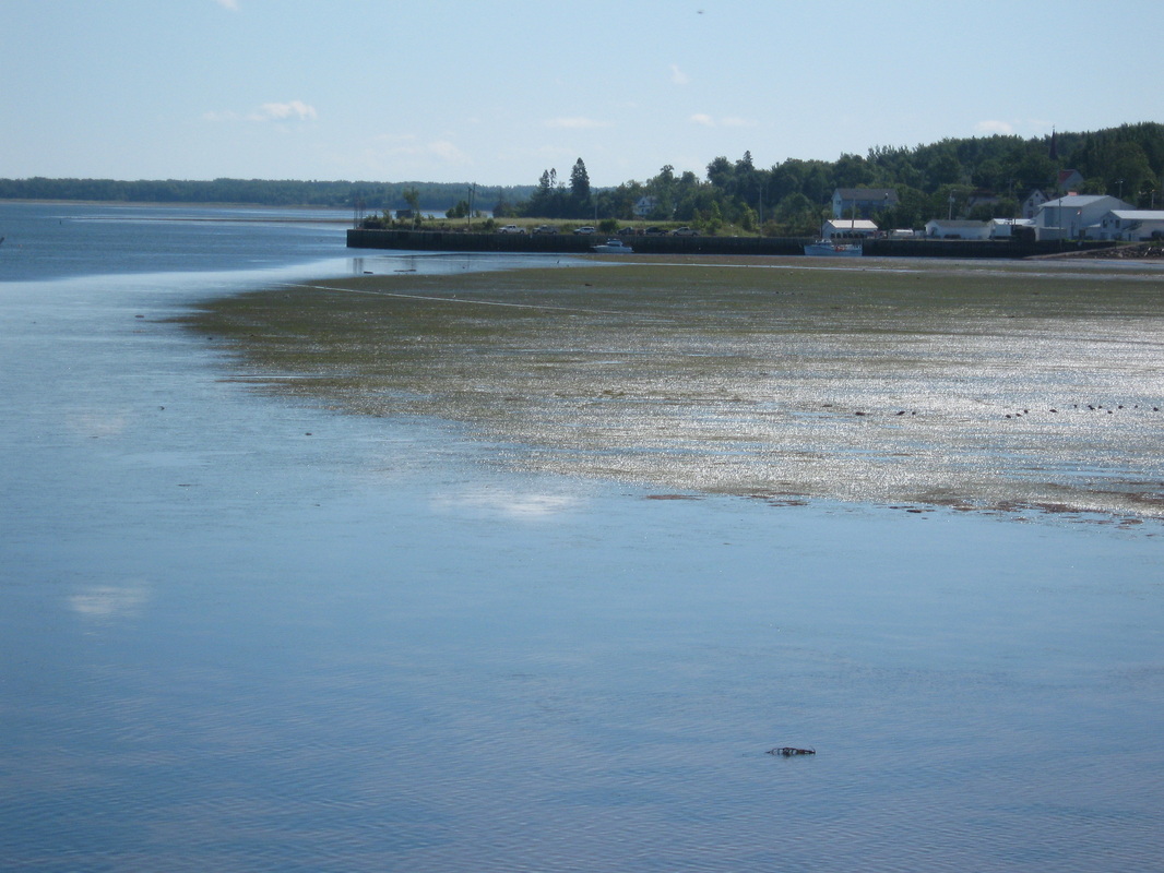
Toney River with Lobster boats - www.elcivics.com
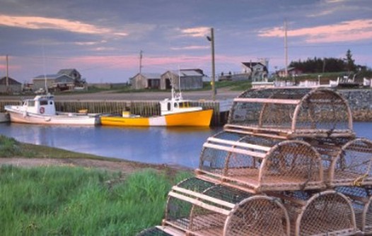
The road is in good shape with recent construction in some areas that have improved the drivability greatly. This area is very scenic, with views of PEI. Villages along the way such as Toney River are home to a huge lobster fishing fleet.
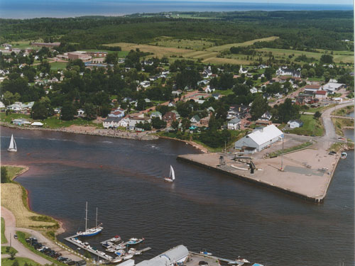
Tatamagouche, Colchester Co., NS --- journalism3073a.wordpress.com
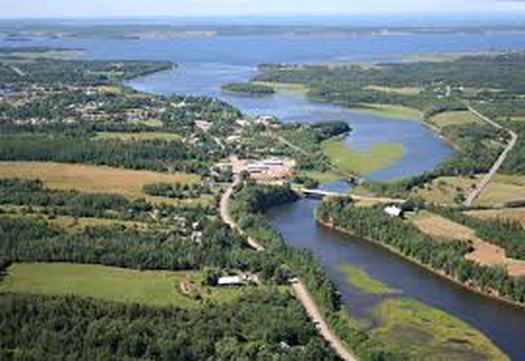
The village of Tatamagouche which, in winter months is very quiet and small, is hopping in the summer as a tourist destination and a place to pick up hand-made crafts, art, vittles, or just to relax in the many seasonal shops.In the distance is the Tim Horton's Summer Youth Camp, and has been a part of the community since the 1988, complete with a paved runway.
Jost Winery overlooking Northumberland Strait. wineriesofcanada.com
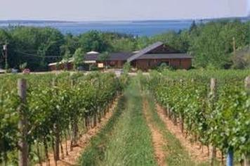
Malagash, home to Jost Vineyards, just a short ride off of Route 6, and Wallace, where you can continue on the main road or take the secondary, more scenic route along the waterfront. If you choose to head off of Route 6 (I highly recommend it, but did not this trip) you will ride by Fox Harbour Golf Resort and Spa where many celebrities have come to relax and play (just a tad expensive for most of us!)
The Village of Pugwash www.villageofpugwash.com
Next is Pugwash, home to Windsor Salt Mine with a working harbour,and a great place to moor your boat. As well, it is the home of Seagull Pewters, and its biggest claim to fame (and it is a "biggie"), it was the sight of the original Peace Conferences (Thinkers Lodge) at the height of the Cold War, put on by Cyrus Eaton. The Thinkers Lodge (www.thinkerslodge.org) was the winner of the 1995 Nobel Peace Prize! Today, it is called the Pugwash Conferences on Science and World Affairs (www.pugwash.org). Pretty impressive, eh?
On to Port Howe, where you can continue on to Amherst Shore and Amherst the town. (that is another trip)
I cut toward Oxford along the River Phillip, where there is one view of the River Phillip from the highest point along the road from the Northumberland to the river valley Oxford is in. Oxford is known as the "Blueberry Capital of Canada" (not just because they have the largest blueberry)

www.canadarentals.net
In Oxford met a group of riders from Quebec, all female, riding Bombardier spyders and having a great time. In their better English than in my embarrassing French, they told me that they love the three wheeled bikes as it gives stability and a self assuredness that some had never really had with two wheeled bikes. As they aged (most were a youngish 45 and up) they found the convenience of three wheels of not having to balance the bike helped, but having reverse aloud them to park in areas with ease. Bonne voyage ladies!
From Oxford to Thompson Station was on the Trans Canada highway (Highway 104) then a diversion off the TCH ( at the point where the NS government decided that a "partnership" would allow for the implementation of a toll highway -$4.25 for a bike, the same as a car! Isn't that what our outrageous gas taxes are supposed to pay for in the first place? Sorry - I digress, I do that a lot)
This Part of the highway, the old TCH is two lane but well maintained and open as compared to a lot of other secondary roads. I spent many nights driving this road early in the morning between Truro and Oxford in a previous life so it was sort of like a home-coming.
The Wentworth Valley ----------------- Photos: G.Matthews
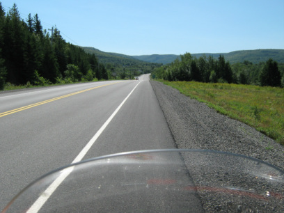
The scenery through the Wentworth Valley is gorgeous, and for a biker, there is the paved shoulder to pull off and look (you will want to do this). Another bike friendly aspect of this part of the road is the fact that large trucks are not to travel on it, other than for local deliveries. (good for bikers, but a way in which truckers are forced to pay the toll on the other highway. This road was good enough for trucks before, why not now? I think we know the answer). Want to picnic, rest or pee? Then take the time to stop at the Wentworth Valley Provincial picnic park and relax.I did. Remember - I am bladderly challenged!
Wentworth Mountain Ski Resort Photo: G. Matthews
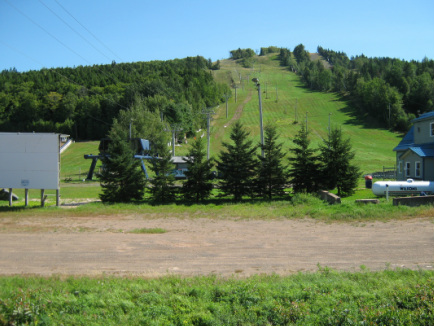
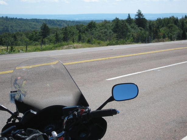
Moving deeper into the Wentworth Valley, you will pass the Wentworth ski hill (largest in NS) and then make the climb in two stages to the top of the Cobequid Hills past Folly Lake and then, cresting the next hill, overlooking the Bay of Fundy in the distance.
(Just be careful at the top of the first hill climbing out (about a 3 km long hill) as there is a quarry entrance at the top, and rocks tend to get on the corner where it comes out)
(Just be careful at the top of the first hill climbing out (about a 3 km long hill) as there is a quarry entrance at the top, and rocks tend to get on the corner where it comes out)
My ride in front of cave my father got an army jeep wedged into during WW2. I didn't attempt to follow in his jeep tracks
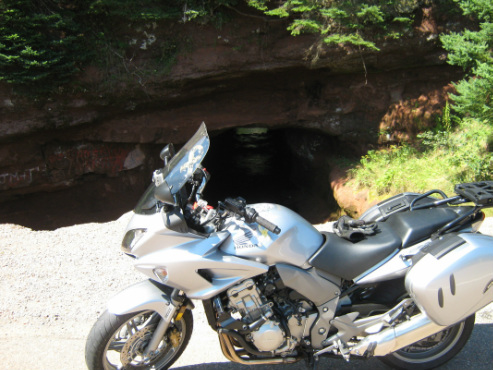
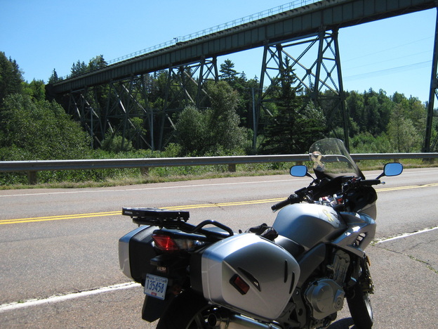
As you descend to the base of the "mountain" you round a turn to see a railway trestle high above you, and on the immediate right you will see a cave that a small river has carved through the sandstone hill. During WW II, my father was in training at nearby Camp Debert and he and a bunch of his buddies "commandeered" a jeep and ended up getting it stuck in the cave as they tried unsuccessfully to drive through it. It took a Six wheeled troop carrier to pull the jeep out because it was wedged in so tight (my father never did say if they got in s--t for this stunt., but did get in trouble for being too much under the influence of “local squeezins”.
Photo: G. Matthews
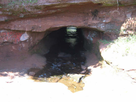
A better look at the cave with the brook running through it. How did all those scrape marks get there? Hmmmmm?
Just past the train trestle, make a left turn toward Debert and Belmont. This road is OK for traveling at 80 km or less, and in single file if group riding.
Just past the train trestle, make a left turn toward Debert and Belmont. This road is OK for traveling at 80 km or less, and in single file if group riding.
Part of the BCATP airfield at Debert, NS It still operates as a provincial airfield.
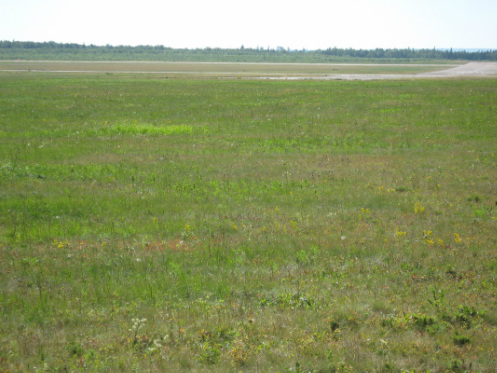
After approximately 8 km, you will come to the village of Debert (during WW II it is hard to imagine that this village was a major Commonwealth training area that had over 10 000 soldiers and fliers here at any one time. You can still see the remnants of that era as you travel through, especially if you visit the Debert Museum, or that symbol of another era - the Cold War- the underground bunker commonly called the "Diefenbunker". As a kid, we used to visit Debert frequently (due to family and my fathers memories), and this is where we used to sit at the end of a runway at Debert Airport and watch the Tracker aircraft from then HMCS Bonadventure and CFB Shearwater doing practice flying. This is where I got a love for flying and went on to become a pilot a few years later. Today, Debert airport is managed by the Truro Flying Club and is home to the Royal Canadian Air Cadets glider school each summer. Also in Debert, you will pass by an area holding the oldest known aboriginal artifacts discovered in NS! The history here is utterly amazing.
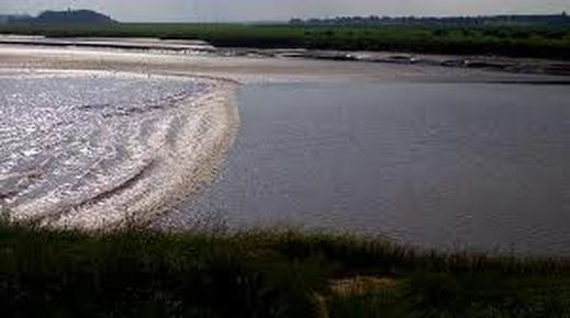
From Debert, the next destination would be Truro - Bible Hill, following the old number 4 highway (reconnecting in Masstown). This road will take you past an abioteau and dykes that were originally made by the French Acadians in the mid 1700's, and are still there today. As I said, the history here is amazing! The road itself follows along the Salmon River (one of umpteen Salmon Rivers in NS), and if you stop in Onslow, just outside of Truro you can watch the Tidal Bore which is a small wall of water rushing up the river as the tides of the Bay of Fundy force water up all rivers emptying into it. The Bore itself may be a bit "boring" to some, but you have to be impressed by the sheer nature that causes it.
From Debert, the next destination would be Truro - Bible Hill, following the old number 4 highway (reconnecting in Masstown). This road will take you past an abioteau and dykes that were originally made by the French Acadians in the mid 1700's, and are still there today. As I said, the history here is amazing! The road itself follows along the Salmon River (one of umpteen Salmon Rivers in NS), and if you stop in Onslow, just outside of Truro you can watch the Tidal Bore which is a small wall of water rushing up the river as the tides of the Bay of Fundy force water up all rivers emptying into it. The Bore itself may be a bit "boring" to some, but you have to be impressed by the sheer nature that causes it.
I did not travel into the town of Truro but bypassed it by heading directly for Bible Hill to Main Street, then up the Pictou Rd (reconnecting with Route 4) and heading to East Mountain and Mount Thom on the way back to New Glasgow. The road is in pretty good shape and easy to ride, especially at 80 km or below, which is the posted speed limit through most of it. The road carries you through areas that was was devastated by spruce beetles killing thousands of trees and then by Hurricane Juan which blew through here and snapped off or blew over those infected trees. As you get to Mt Thom you are in a slower, more treed area that presents more twists, just what a biker wants. Although the road is not the greatest, it is not bone jarring. The trip itself getting back to New Glasgow was not long, approximately 5 hours when all the stops are factored in. Over-all, a delightful day on the road (and also a trip down memory lane).
